Map - Braga

Braga
Braga (, ; Bracara) is a city and a municipality, capital of the northwestern Portuguese district of Braga and of the historical and cultural Minho Province. Braga Municipality had a resident population of 193,333 inhabitants (in 2021), representing the seventh largest municipality in Portugal by population. Its area is 183.40 km2. Its agglomerated urban area extends from the Cávado River to the Este River. It is the most populated urban area in Portugal outside Lisbon and Porto Metropolitan Areas.

It is host to the oldest Portuguese archdiocese, the Archdiocese of Braga of the Catholic Church and it is the seat of the Primacy of the Spains. During the Roman Empire, then known as Bracara Augusta, the settlement was the capital of the province of Gallaecia and later of the Kingdom of the Suebi that was one of the first to separate from the Roman Empire. Inside of the city there is also a castle tower that can be visited. Nowadays, Braga is a major hub for inland Northern Portugal and it is an important stop on the Portuguese Way path of the Road of St James. The city was also the European Youth Capital in 2012.

 
Map - Braga
Map
Google - Map - Braga
Google
Google Earth - Map - Braga
Google Earth
Nokia - Map - Braga
Nokia
Openstreetmap - Map - Braga
Openstreetmap
Map - Braga - Esri.WorldImagery
Esri.WorldImagery
Map - Braga - Esri.WorldStreetMap
Esri.WorldStreetMap
Map - Braga - OpenStreetMap.Mapnik
OpenStreetMap.Mapnik
Map - Braga - OpenStreetMap.HOT
OpenStreetMap.HOT
Map - Braga - OpenTopoMap
OpenTopoMap
Map - Braga - CartoDB.Positron
CartoDB.Positron
Map - Braga - CartoDB.Voyager
CartoDB.Voyager
Map - Braga - OpenMapSurfer.Roads
OpenMapSurfer.Roads
Map - Braga - Esri.WorldTopoMap
Esri.WorldTopoMap
Map - Braga - Stamen.TonerLite
Stamen.TonerLite
Country - Portugal
Flag of Portugal
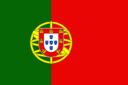
Portugal, officially the Portuguese Republic (República Portuguesa ), is a country located on the Iberian Peninsula, in southwestern Europe, and whose territory also includes the Atlantic archipelagos of the Azores and Madeira. It features the westernmost point in continental Europe, and its Iberian portion is bordered to the west and south by the Atlantic Ocean and to the north and east by Spain, the sole country to have a land border with Portugal. Its two archipelagos form two autonomous regions with their own regional governments. Lisbon is the capital and largest city by population.

One of the oldest countries in Europe, its territory has been continuously settled, invaded and fought over since prehistoric times. The territory was first inhabited by pre-Roman and Celtic peoples who had contact with Phoenicians, ancient Greeks and Carthaginians. It was later ruled by the Romans, followed by the invasions of Germanic peoples and the Islamic invasion by the Moors, whose rule was eventually expelled during the Reconquista. Founded first as a county of the Kingdom of León in 868, gained its independence as the Kingdom of Portugal with the Treaty of Zamora in 1143.
Currency / Language  
ISO Currency Symbol Significant figures
EUR Euro € 2
ISO Language
PT Portuguese language
Neighbourhood - Country  
  •  Spain 
Administrative Subdivision
Country, State, Region,...